


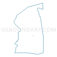
Voting District 0217073, Nassau County, New York
About
Outline

Summary
| Unique Area Identifier | 631114 |
| Name | Voting District 0217073 |
| County | Nassau County |
| State | New York |
| Area (square miles) | 0.02 |
| Land Area (square miles) | 0.02 |
| Water Area (square miles) | 0.00 |
| % of Land Area | 100.00 |
| % of Water Area | 0.00 |
| Latitude of the Internal Point | 40.69119990 |
| Longtitude of the Internal Point | -73.55081560 |
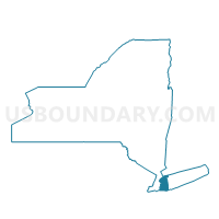
Maps

Graphs
Select a template below for downloading or customizing gragh for Voting District 0217073, Nassau County, New York


Neighbors
Neighoring Voting District (by Name) Neighboring Voting District on the Map
- Voting District 0217012, Nassau County, NY
- Voting District 0217055, Nassau County, NY
- Voting District 0217061, Nassau County, NY
- Voting District 0219030, Nassau County, NY
- Voting District 0219031, Nassau County, NY
Top 10 Neighboring County Subdivision (by Population) Neighboring County Subdivision on the Map
Top 10 Neighboring Place (by Population) Neighboring Place on the Map
Top 10 Neighboring Elementary School District (by Population) Neighboring Elementary School District on the Map
Top 10 Neighboring Secondary School District (by Population) Neighboring Secondary School District on the Map
Top 10 Neighboring State Legislative District Lower Chamber (by Population) Neighboring State Legislative District Lower Chamber on the Map
Top 10 Neighboring State Legislative District Upper Chamber (by Population) Neighboring State Legislative District Upper Chamber on the Map
Top 10 Neighboring 111th Congressional District (by Population) Neighboring 111th Congressional District on the Map
Top 10 Neighboring Census Tract (by Population) Neighboring Census Tract on the Map
- Census Tract 4148, Nassau County, NY (6,614)
- Census Tract 4085, Nassau County, NY (6,153)
- Census Tract 4147, Nassau County, NY (4,588)
- Census Tract 4084, Nassau County, NY (3,961)